« `html
Exploring the Rich Geological Tapestry of Martinique
Martinique, nestled in the heart of the Caribbean’s Lesser Antilles, is an island that boasts a dramatic geological heritage shaped by its volcanic origin. The island’s varied volcanic landscapes are both strikingly beautiful and scientifically intriguing, making Martinique an idyllic destination for geologists and nature enthusiasts alike. This article delves into the vibrant volcanic features and geological wonders that paint Martinique’s terrain, offering a glimpse into its fiery past and the natural forces that have sculpted its present-day allure.
Unveiling Martinique’s Volcanic Origins
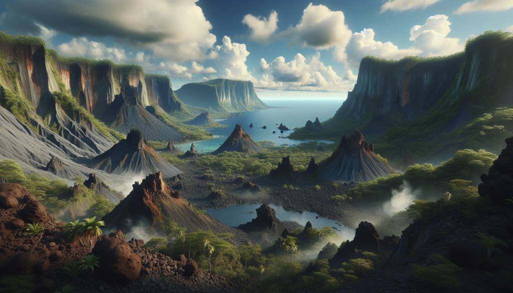
The island of Martinique is part of a volcanic arc formed by the subduction of the Atlantic Ocean’s plate beneath the Caribbean plate. This tectonic activity has given rise to several notable volcanoes, including the infamous Mount Pelée, whose eruption in 1902 stands as one of the most catastrophic in history. The pyroclastic flows from Mount Pelée’s eruption completely destroyed the city of Saint-Pierre, once known as the « Paris of the Caribbean, » leaving a sobering yet fascinating footprint for geological study.
Mount Pelée: A Volcano Steeped in History and Activity
Mount Pelée remains an active volcano, and its complex stratigraphy draws geologists and vulcanologists from around the world. Its current dormant state allows for safe exploration of the summit and surrounding areas, where one can witness the remnants of lava domes, pyroclastic deposits, and lahars. The volcano’s rich volcanic soils also foster a lush and diverse ecosystem, further enhancing the appeal for a wide range of scientific and ecological research.
Discovering the Carbet Pitons: Remnants of Ancient Eruptions
Beyond Mount Pelée, Martinique’s landscape is dotted with other geological marvels, such as the Carbet Pitons. These ancient volcanic remnants, towering majestically over the island, are evidence of the seismic forces that have shaped Martinique over millions of years. Hiking through the dense rainforests to reach their peaks offers not only a breathtaking view but also a hands-on experience with the island’s igneous formations and the erosional processes that expose them.
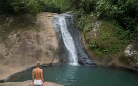
Delving into the Depths of Martinique’s Volcanic Caves
For a subterranean perspective, the numerous volcanic caves scattered across Martinique present another dimension of geological exploration. These caves, often formed by flowing lava tubes, provide unique insights into the island’s volcanic plumbing system. Stalactites and stalagmites found within them tell a story of the slow, mineral-rich seepage of groundwater over time, contrasting with the violent eruptions that once birthed these caverns.
A Study in Contrasts: Martinique’s Black and White Sand Beaches
The diversity of Martinique’s volcanic landscape extends to its coastlines, where black sand beaches, a direct result of eroded volcanic material, stand in stark contrast to the idyllic white sand beaches derived from coral. Grand Anse des Salines, for example, showcases a white sand beach, while the northern shores near Mount Pelée exhibit the darker volcanic sands. These beaches not only serve as a testament to Martinique’s geodynamic evolution but also attract geotourists and beachgoers seeking a unique seaside experience.
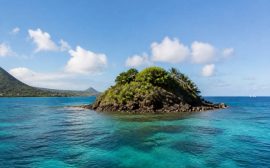
The Diamond Rock: A Geologic Landmark at Sea
Off the coast of Martinique, the Diamond Rock is a volcanic islet that juts out from the sea, creating a striking natural monument. This basaltic rock formation, once used as a fort by the British navy, has a rich history entwined with its geologic origins. The rock is also a magnet for divers, who explore the reef’s marine biodiversity that flourishes around the submerged volcanic base.
Assessing the Impact of Volcanism on Martinique’s Environment
The forces of volcanism and subsequent erosion have not only carved out Martinique’s dramatic landscape but also influenced its soil composition and agricultural richness. The fertile lands are ripe for the cultivation of sugarcane, bananas, and pineapples, among other crops. This rich agricultural tapestry is tied closely to the island’s volcanic soil, which is dense in nutrients and supports diverse flora and fauna.
The Role of Preservation and Education in Martinique’s Volcanic Landscape
With the growing interest in geotourism, efforts to preserve Martinique’s volcanic landscapes have intensified. Educational programs and guided tours aim to inform visitors about the importance of these natural features, their role in local biodiversity, and the need for conservation. Interpretive trails, such as the Route de la Trace in the northern rainforests, allow visitors to immerse themselves in the island’s geology while emphasizing the significance of environmental stewardship.
Embracing Technology and Research for Volcanic Monitoring
Embracing advancements in technology, Martinique’s observatories and research stations employ modern methods to monitor the island’s volcanic activity. These facilities are crucial for predicting potential eruptions and ensuring the safety of both residents and tourists. Additionally, they provide data that contribute to the global understanding of volcanic behavior and natural disaster management.
Final Thoughts on Martinique’s Volcanic Wonders
Martinique’s volcanic landscapes are a testament to the Earth’s dynamic nature and stand as a geologist’s dream for exploration and study. From the fiery peaks of Mount Pelée to the tranquil depths of its volcanic caves, the island offers a multifaceted canvas of geological intrigue. Whether for scientific research or the pursuit of natural beauty, Martinique’s volcanic offerings are an enriching chapter in our planet’s geological storybook, waiting to be discovered and appreciated.
« `